Aerodromes
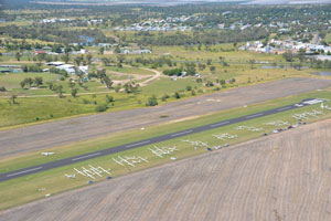
Goondiwindi Aerodrome
Cunningham Highway, Goondiwindi Qld 4390
For further information, please contact:
Goondiwindi Regional Council
Locked Mail Bag 7
Inglewood Qld 4387
Ph: (07) 4671 1512
Fax: (07) 4671 7433
Airstrip Details:
-
Direction of township - 197° magnetic, 2 nautical miles
-
Aerodrome Reference Point - 28° 31.6' S - 150° 19.5' E
-
World Aeronautical Point - WAC 3357
-
Aerodrome Elevation - 714ft above mean sea level
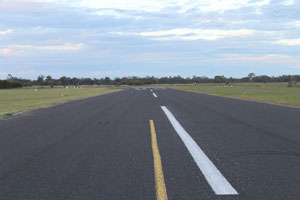
Runway Information for RWY 04/22:
-
Runway Bearing - 033 degress magnetic
-
Length 1340m x 30 m wide
-
Slope 0.1% down to NE
-
Length of Clearway - 60m each end
-
Dimension of Runway Strip - Length 1460m, width 50m (graded 90m)
-
Surface - sealed bitumen
Runway Information for RWY 12/30:
-
Runway Bearing - 123 degrees magnetic
-
Length 795m x 30m wide
-
Slope 0.1% down to SE
-
Length of Clearway - 60m each end
-
Dimension of Runway Strip - Length 915m, width 90m
-
Surface - grey clay
Inglewood Aerodrome
Aerodrome Road, Inglewood Qld 4387
For further information, please contact the Customer Service Office on (07) 4652 0200.
AIRSTRIP DETAILS:
- GPS Position: Latitude 28°25' Longitude 151°06'E
- Elevation above sea level (in feet) - 934 FT
- WAC Chart: Armidale (3357)
- Direction - 05/23degs
- Length - 1100 mtrs
 Both airstrip and parking area sealed bitumen
- Windsock position relative to airstrip - NE corner
- Parking area relative to airstrip - North Side
- Airstrip location relative to airstrip - East of Town
- Solar lighting
- Strip Markers: White cones
- VHF or UHF frequencies used by ground support vehicles or bases - FIS BN 121.2
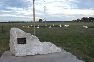
Texas Aerodrome
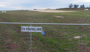
Texas-Yelarbon Road, Texas Qld 4385
For further information, please contact:
Goondiwindi Regional Council
Locked Mail Bag 7
Inglewood Qld 4387
Ph: (07) 4671 7400
Fax: (07) 4671 7433
Airstrip Details
- Geographical Location: 28°50'4.74" S - 151° 9'9.42" E
- Aerodrome Elevations / Altitude: About 1014FT (309m) above main sea level
- World Aeronautical Point - WAC 3357
Runway Identification: RWY 09/27
- Runway Bearing - 82.8º magnetic
- Dimensions of Runway: The runway approximately 830m (rounded) long by 15m wide as defined by white runway THR mini cones markers and the width of the gravel runway.
- Clearways: 30m marked clearways each end.
- Dimensions of Runway Strip: Graded and maintained at about 890m (rounded) by 45m as defined by standard white cone markers
- The average slope over the runway length is 1.6% down to W
- Surface - graded gravel